


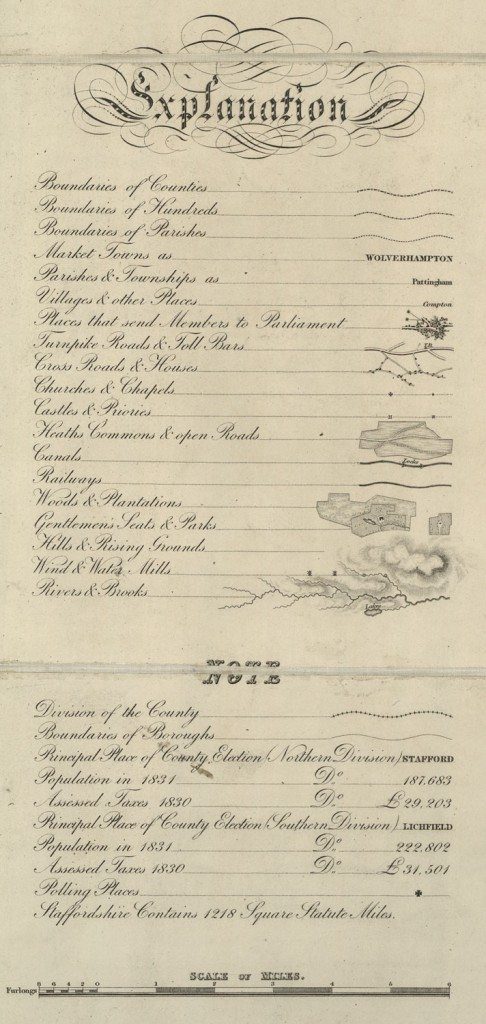
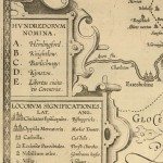
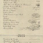
Keys and Explanations
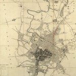
Image: Key from map of Staffordshire, Phillips & Hutchings, 1832.
Image from: Local Studies and History, Birmingham Central Library
The key includes new symbols which reflect contemporary society, and recent history. Railways were very new at that time, but already there is a symbol for them. The Reform Act was passed in 1832; there is a symbol for ‘Places that send members to Parliament’ and under the Notes there is also a symbol for Polling Places. The Note also gives statistics about the population. Toll bars on roads are indicated, and locks on canals. There is artistry in the combination of some signs in the key. The hachuring which shows hills is extended so that it lies around the sign for rivers, and the signs for wind and watermills are placed so that the windmills are on high ground, and the watermills are on the rivers
« Previous in this sectionNext in this section »Continue browsing this section
 Maps and Map Making: the West Midlands Experience
 Early Warwickshire Maps
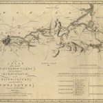
 The First Road Maps, John Ogilby, 1697
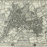 William Westley’s Plan of Birmingham, 1731
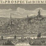 William Westley’s Prospect of Birmingham, 1732
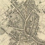 Birmingham in 1751
 Keys and Explanations
 Keys and Explanations
 Canal Maps
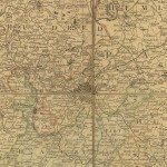 Birmingham and the Country Around, 1798
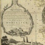 Cartouches
 Birmingham in 1810
 Tithe Maps