

Maps and Map Making: the West Midlands Experience
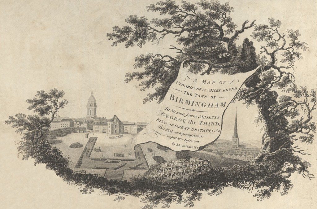
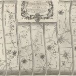
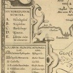
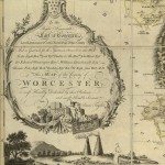
Image: Cartouche from James Sherriff’s map of the area for 25 miles around Birmingham, 1798.
Image from: Local Studies and History, Birmingham Central Library
The cartouche uses the conventions of eighteenth and early nineteenth century maps of cities. As was often the case, there are pictures of the most significant churches, St. Philip’s on the left, in the modern part of Birmingham on top of the hill; St. Martin’s on the right, lower down, surrounded by houses. There is a framework of a tree and leaves, also a convention. But St. Philip’s lies in the background, in the foreground there are wharves, canals and barges, loading coal. There is also a small figure, leading horses. The scroll with the title hangs down between the two churches, disguising the fact that in reality they could not have been seen in such proximity.
Summary
In the 1570s, Christopher Saxton, a Yorkshire surveyor, was commissioned to produce the first detailed survey of England and Wales. Elizabeth I granted Saxton the lease of lands in Suffolk, because of the ‘grand charges and expenses lately had and sustain’d in the survey of divers parts of England’. Her chief minister, Lord Burghley, used maps extensively for administration and there are copies of Saxton’s county maps with his annotations.
Over the next two and a half centuries there were changes in the economy and society of the country, and these changes were reflected both in the landscape, and in maps. In 1700 one person in six lived in a town, by 1800 this had doubled to one person in three. Birmingham grew from a small market town on the edge of Warwickshire to one of the major towns in the country. As scientific accuracy came to be more highly valued and new technology meant better tools for surveying. By 1830 there was a substantial middle class who could afford to buy maps. Some were produced as luxury items as well as guides.
Next in this section »Continue browsing this section
 Maps and Map Making: the West Midlands Experience
 Early Warwickshire Maps
 The First Road Maps, John Ogilby, 1697
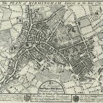 William Westley’s Plan of Birmingham, 1731
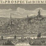 William Westley’s Prospect of Birmingham, 1732
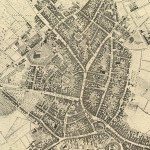 Birmingham in 1751
 Keys and Explanations
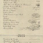 Keys and Explanations
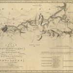 Canal Maps
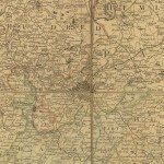 Birmingham and the Country Around, 1798
 Cartouches
 Birmingham in 1810
 Tithe Maps
Sources and Further Reading
All maps on these pages are held in the Local Studies and History section of Birmingham Central Library. I would like to thank Richard Abbott, the maps librarian, for his advice.
Evans, Eric J, Tithes and the Tithe Commutation Act (London, 1978).
Harvey, P D A, Maps in Tudor England (London, 1993).
Harvey, P D A, and Thorpe, Harry, The Printed Maps of Warwickshire (Records and Museums Committee, Warwickshire, 1959).
Hindle, Paul, Maps for Local History (London, 1988).
Hutton, William, An History of Birmingham, first edition 1782 (Wakefield, 1976).
Raven, Jon, The urban and industrial songs of the Black Country and Birmingham(Wolverhampton, 1977).
Smith, David, Maps and plans for the local historian (London, 1988).
Tooley, R V, Tooley’s Dictionary of Mapmakers (Tring, 1979).
Uglow, Jenny, The Lunar Men (London, 2003).
van Erde, Katherine, John Ogilby (Chatham, 1976).